USGS McGREGOR MOUNTAIN
| NAME | ELEV. | SADDLE | PROM. | JWR | |||
| McGregor Mountain | 8122 | 6000 | 2122 | 8/12/1984 | |||
| Frisco Mountain | 7760 | + | 7280 | 480 | 10/12/1975 | ||
| Mount Benzarino | 7720 | + | 7040 | 680 | 7/25/1976 | ||
| McGregor BM (1') | 7424 | 6920 | 504 | 8/11/1984 | |||
| Obscure Peak' fa | 6980 | 6480 | 500 | 8/12/1984 |
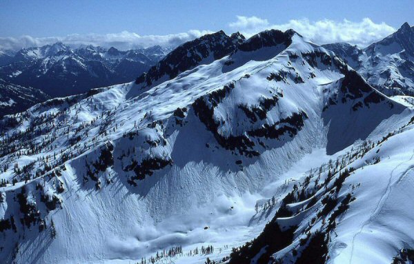
Mount Benzarino 7720+ P680
USGS McGregor Mountain
July 25, 1976
Solo on the two 7720+ peaks on left, where the map name is located.
June 16, 1984
on the other three 7720+ contours (5 total) on right, when this photo was taken from Corteo
Thanks to Russ Kroeker
When this was soloed on 7/25/76, up the left ridge in this photo, approaching from Maple Pass, there was no evidence of previous ascent on top. At that time, I knew of Harry Majors' note in Exploring Washington (1975) stating that Lage Wernstedt had climbed Benzarino in 1926 (p. 45, note 229). On our 1984 climb the NE summits were at least partially covered in snow. In 1976, the possibility of Wernstedt's climb was suspect to me, but when the first ascent history of Washington's 100 Highest Peaks was being researched (12/2004), and Harry Majors came up with Lage's photo numbers on Benzarino, his case was made. So I'm taking this one off the FA shelf, but this was such a nice photo, and a piece of mountain history that is not in CAG that I decided to at least leave it on this page.