Easter in Eastern WA, Round 4
©John Roper
April 10-11, 2004
WA DeLorme Atlas pages 69,70,71,72,73,88,89, and 54
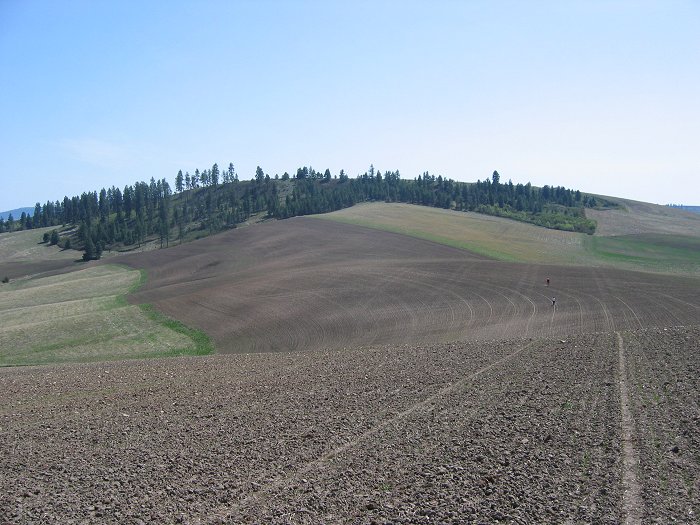
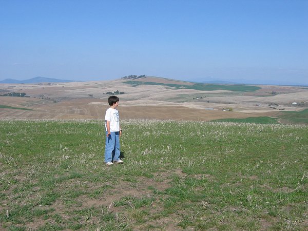
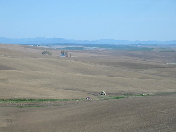
Climbers (right center) descending Hansen Butte, tick city
April 10, 2004
This was now the fourth annual April trip that Jeff Howbert, son Aaron (now 10), and I have taken to E WA over Aaron's spring break. Austin Post has joined us on three of these journeys and always entertains us with his interesting glaciology, geology and history insights. Previously we'd cleaned out most of Douglas County and a fringe of Okanogan County, so we were looking for new ground and found it along the I-90 corridor between Ritzville and Spokane, then down south along the Idaho border, and back west along the Palouse River.
What is "the Palouse," besides the place the WSU Cougars come from? It's the huge area in E WA and Idaho between the Spokane and Walla Walla/Snake Rivers, west of Moses Lake and into Idaho where the basalt flows and scabland are buried by a rich fine soil, called loess, up to 100 feet think--silt blown in by the winds from the SW over centuries. Come back in a millenium or two, and the summits will be in different places. These photos paint the picture. The French word for lawn is "pelouse."
It is rare that I get to suggest an addition to Jeff's Washington Master List, so I was happy when he actually seemed to enjoy the concept of Marsh Island in Moses Lake (click on link for a map), a perfectly flat, appropriately-named WA landform (DeLorme p.69). After getting off I-90 for gas at Moses Lake, and looking at the approach from the west, we discovered that the freeway went right over the island on a causeway, so we returned to I-90 and drove over the island at 70 mph, counting the summit as "climbed," even though we opted not to Martinize it (a term honoring Andy Martin who located the high point of every county in the US, who winks that to count a summit you drive up requires at least one foot out the car door onto ground).
The two pages east of Moses Lake in DeLorme (pp.70-71) are topographically boring anomalies, statistically. However, in real life the landscape is quite pleasant as the hills of Palouse loess start undulating above the George-Moses Lake scabland, and petite basalt coulees appear.
Using Jeff's exacting map research before the trip, I marked my DeLorme Washington Atlas for potential goals and noticed that the 16 7.5-minute USGS quads that make up DeLorme page 70 have zero summits with >400 feet of prominence, and only one landform with a name on the maps, Coffeepot Butte , and that one was out of the way enough to leave for later. Interestingly (or not), the exact same situation exists on DeLorme page 71 where there are also no 400' prominence summits, and only one named feature, Karakul Hills (which happens to be the highest point in Adams County). This wheat field was tempting to repeat, but we had smaller fish to fry.
To break the monotony along this stretch, I thought it might be interesting to visit some of the features that the various quads in this area are named for, so we turned off I-90 to investigate Schrag , the namesake of this USGS quad. In real life, Schrag turned out to be a collection of well-maintained, white warehouses and silos, unexciting enough to further cure us of this pursuit. Many of the quads in the Palouse are named for whistle stops along the railroad tracks.
Finally getting down to peak bagging, we pulled off the freeway at Sprague (another quad name), DeLorme page 72, which has a picturesque brick church built in 1902. Jeff coyly requested a stop at the country store here to get something, for celebrating later. From Sprague, we drove NE on Old State Highway to climb Watermelon Hill from the west and Square Butte from the east. Watermelon is not named in DeLorme. It had an interesting groove paralleling and just under the summit crest on the NW side which turned out to be a cow/animal path. Why the animals chose this route on the steep bank instead of a path right over the top was a mystery.
Watermelon Hill
Crux on Watermelon per Aaron
Next it was on to Lance Hills which is a very complex, labyrinthine, soft bumpy landform on the map--and in the field--nine miles NE of Square Butte. Jeff recorded that the high point (HP) here was 2500+. I looked all over Lance Hills on my Topo! software and failed to spot his 2500+ summit. I did identify 10 (ten!) different 2490+ contours (on this 10-foot interval map), including the 2498 Pence BM, at the very NE part of this landmass. I finally surrendered and asked Jeff to identify the top that he had found, and damned if he had not nailed a 2500+ Lance Hills summit, hidden under a section line. So this is the summit we climbed, from the north, along a half section fence line over a field in fallow. But when we got to the top of the USGS 2500+ contour, it was clear that the 2490+ hump to the east was higher, so we wandered over here, of course, and wondered if the real HP wasn't indeed Pence BM 2498. Driving around and looking at that spot from the east and south, we passed on this point, since this was a plowed field right above a house with barking dogs.
Lance Hills from the north
In the immediate neighborhood was Bunker Hill , most unimpressive. We approached along the RR tracks from the NE, running into a "No Trespassing" barbed-wire fenceline just short of the summit (with no one around).
Back in the car, we drove to Cheney to have lunch on the Eastern Washington University campus, and looked at the field the Seahawks practice on in the summer. Here we hatched the plan to do a counter-clockwise attack on the named summits on DeLorme page 88, north and west of Medical Lake and Fairchild Air Force Base. We started with McDowell Hill , driving up a Private road from the east. The summit is surrounded by a chain fence with three strands of barbed-wire on top and "No Trespassing" signs, so when mean-looking barking junk-yard dogs circled the Subaru before we could knock on the caretaker's door, we left. Aaron and I get a minus for this. Jeff won't count it.
Next, it was off to Shoemaker Butte 3001' with a respectable 521 feet of prominence. "No Trespassing" signs foiled us from the east, but the route from the south under the powerlines was not signed. We did not find the Crescent BM here, but the top sported a red Great Northern RR caboose, complete with decks, a satellite dish, Christmas lights, and firewood. While Austin waited for us to summit and return, a herd of 8 deer walked by him over a fresh green wheatfield.
Shoemaker Butte (P521') from Gettys Butte
Quite a nice house with stone columns, a square turret, and green lawn stands just NE of Grays Butte, which Jeff asked us to bypass and come back to, after Gettys Butte . We were lucky on Gettys, as a summer road (only open April 1-Nov 1) led up to the crest from the north, where a faint path led to the 2806 top. A fancy house sits on the 2800+ summit to the west.
We reversed our route and returned to Grays Butte which has a road to the top from the east and an open gate leading to a minor tower. Here atop, Jeff announced that this summit was his 1000th different lifetime peak, a rare achievement in this world! He pulled out a bottle of fine Andre champagne (purchased in Sprague), and we adults celebrated his worthy accomplishment in style.
Jeff Howbert toasts his 1000th Peak, Grays Butte
Now we headed south 10 miles on Waukon Road to turn west to follow a gravel road to the top of Magnison Butte . There is a radio facility here and a sign proclaiming the east slope of the hill as a Nature Conservancy protected area of local scrub grasses, dedicated to the Magnesons which apparently is the correct spelling.
From the top, we could spot a road going to the summit of Hanning Butte to our north which does not show on the USGS map. So it was back out to Waukon Road, then up a dirt road from the east to a gated road No Access, except by permission by a farmer's group south of the summit. We assumed this meant for vehicles only and made quick work of this 609-foot prominence top with a 1950 BM.
Austin, Jeff, and Aaron on Magnison Butte, looking north to Hanning Butte
We hoped to find a camp spot in Medical Lake, on Silver Lake, to allow us to climb Riddle Hill at dusk. However, the road to Riddle is signed "No Trespassing" on US Land, and the campground was oriented to trailers, so we poked around some more and finally ended up at a great spot, Riverside State Park in west Spokane along the river at Bowl and Pitcher. I was happily flabbergasted that there were open spots in a State Park so close to a big city. It was just getting dark as we pitched our tents, built a fire, and had dinner. Aaron and I roasted hard marshmallows and discussed how only two Webelos II scouts were going to pull off the Johnny's Down skit at Cub Scout camp this summer. Aaron concocted a science project on "How to soften hard marshmallows."
This was Easter, and my dad's 89 th birthday. We woke up to a perfect day, and Aaron noted that the Easter bunny had paid a visit, so gathering was done around breakfast. After breaking camp, we walked down to see what the Bowl and Pitcher was all about. Wow! Some tremendous (one close to 100' high) Easter egg shaped basalt boulders line the shore of the rambunctious whitewater Spokane River here. There is one formation that Jeff thought looked like a pitcher with a lopped-off top, and a handle on the side. There was a carved out area nearby that could be called a bowl, or perhaps the big Easter egg behind the Pitcher is the Bowl. Curious about whether these formations had ever been climbed, I emailed the Park afterwards and was told that "somehow they climb both formations, but we do not recommend it." A solid refurbished CCC bridge spans the canyon here. Aaron and I scrambled the basalt high point of the Park and call it Big Pitcher . The park ranger here related that the Park is first-come-first-served, and though weekends during Spokane's spring break and May-June are often full, the rest of the year and mid-week usually has open spots. Highly recommended!
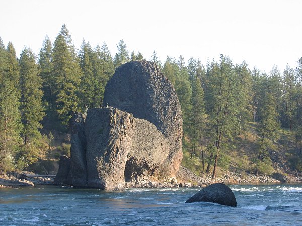
Bowl and Pitcher
We thought that Beacon Hill and Little Baldy , named summits in NE Spokane, would be easy pickings, but the folks owning the communication towers on the tops of each make it clear that the public is not welcome. So we next headed due south of Spokane (still on DeLorme page 89) to try to pick up a cluster of four named summits on the hills above town, high and moist enough to sport ponderosa pine. After poking around a bit, and talking to a local couple out for a walk, we ended up climbing Browne Mountain from a development of expensive houses high on its west flank, finishing on a gated water department road that suggests one get permission. Four big barking dogs charged us from a house near the top. Luckily they responded to a little sweet talk. The top opened up for good views to Mount Spokane, still snowed in.
We tried and failed on Krell Hill and Big Rock due to private property and other negative signs from the NW. We had more luck on Silver Hill from the north, but we were obviously stepping through a barb-wire fence on private property in full view of a couple of houses. The top is interesting in that huge, deep grooves were dug in the ground to unearth silver, I presume. The map here is labeled Strip Mine and the USGS symbol for intricate surface area overlies the summit.
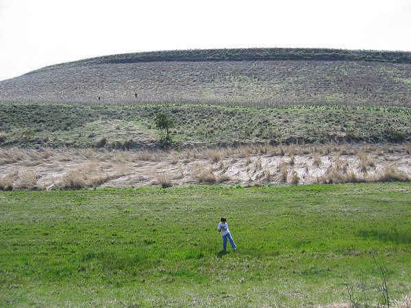
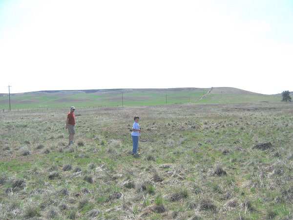
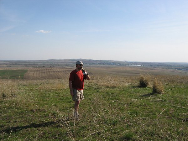
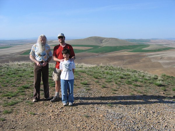
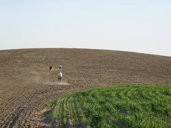
As we headed south onto DeLorme page 73, we could look back and see how the Big Rock plug got its name (there are actually a couple of them). When we drove to the saddle separating Morefield Butte from Hansen Butte , it was clear that we could be spotted crossing these young wheatfields from the farmer's house, so we stopped in to ask permission. Finding no one home, we figured they must have been at Easter services, so we dashed for these hills, and got them without being noticed. Morefield had a broken down shack on top, and Hansen had a shale top that had been mined a bit. Most of the bigger hills in this area of the Palouse have trees on the north sides, presumably owing to snow drifts and shade, but are bare on the south. All day long we'd been flicking ticks off ourselves, but Hansen provided an especially big crop. Karen discovered the last two ticks on me at home after I'd taken my shirt off, which made 18 for the weekend on me alone! Aaron and Jeff both removed around half that many each, but for some reason, Austin had only one (hiding under his watch). Luckily none of them had burrowed in.
Subaru parked for Morefield Butte with higher mountains in Idaho behind
Starr Butte was a pleasant surprise, after a morning of private property concerns, as we were welcomed and directed to the top by a sign reading, Starr Butte, Astronomical Observing Site Dedicated to the Memory of Orland Ostheller. The summit is a huge flat grassy field, with outhouses and views into more mountainous Idaho, as well as the eastern Palouse. This would make a good destination campsite. A summit named Ringo Butte lies 37 miles south of Starr, also right along the WA-Idaho border. Is this mere coincidence, or is there a Beatle fan out there? (Probably coincidence, since there is a "Ringo" RR stop nearby.)
We drove 4 miles south on Starr Road and checked out the access to the 566-foot prominence north peak of Tekoa (tee'-koh) Mountain, but grassy grown-over roads and signs rejected us, so we continued on to the small town of Latah (lay'-tah) and took a picture of the old White Swan Hotel, now decaying. Austin told us about the "Latah Formations," sedimentary beds with fossilized leaves in the ancient silty lake bottoms that formed and were trapped between the various flows of the Columbia River basalt oozes. I read later in Exploring Washington's Past, that mammoth bones were found nearby in 1878 and are now on display at the Chicago Museum on Natural History.
Next we turned our attention to Tekoa Mountain which has several reasons to recommend itself. First, it is a rare 4009 foot peak in this part of WA, and it has over 1000 feet of prominence. Best of all, it is the highest point in Whitman County. Because of this, Aaron, Karen, and I had climbed it back in 1994. Our gang repeated the climb today via Subaru over a rough road to the top, and I picked Aaron up on my shoulders and had Jeff shoot a picture of us to try to duplicate the photo Karen took of Aaron and me 10 years ago when he was 10 months old. Maybe we'll return again in another 10 years, but I'm pretty sure I won't be getting him up on my shoulders then. We gave my dad a birthday call from Tekoa.
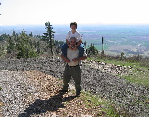
John and Aaron on top of Tekoa Mountain, highest point in Whitman County.
Steptoe Butte shows faintly to the right of Aaron.
By now it was time to head for home, though we'd left a lot undone. From Tekoa we went through Oakesdale, then between Granite Butte and Steam Shovel Hill , which will be better done after harvest, to Colfax then west on HW 26 to Washtucna, here angling SW to Kahlotus for one more Washington curiousity--a couple actually, on DeLorme page 54.
The night before our trip, while Austin and I were reviewing the USGS maps and the raised plastic Hubbard map of this area, Austin wondered if Devils Canyon between Kahlotus and Lower Monumental Dam on the Snake River was the work of man because it was so straight. But the thought of man digging a 500-foot deep ditch in basalt even for a railway seemed too much, and indeed the canyon is natural. Man did make a tunnel for the rail line though (now abandoned), through the ridge separating Devils Canyon and Washtucna Coulee.
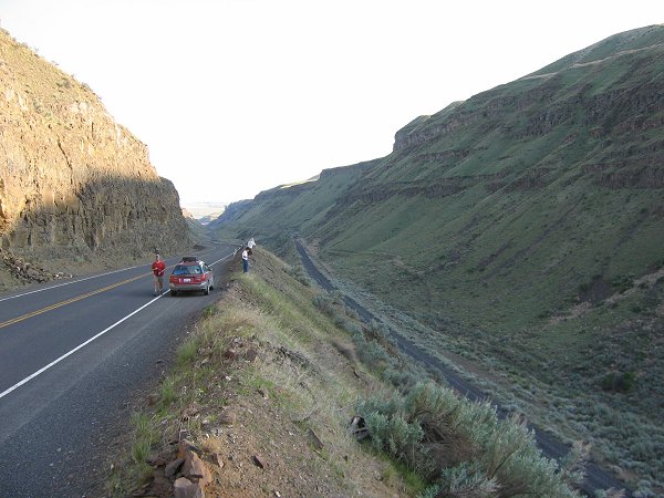
Devils Canyon
At the site, Jeff theorized that the canyon was a fault line, accounting for its remarkable straightness, then later while looking at DeLorme, he noticed that the Palouse River takes much the same deviation as it escapes the upper Washtucna Coulee to head SSE for the Snake River. Very interesting.
Franklin County Greatest Prominence Point (GPP)
But our goal in this area was not to look down into a valley, but to go up--up to a 1584 foot piece of land marked Hunt, a benchmark labeled on the map. Jeff had calculated this point to have 554 feet of prominence, no easy discovery in this low profile county. I'd taken for granted that the 1650+ foot (500 meter) Franklin County High Point 17 miles to the NE would also be the county GPP winner, but its 541 feet of prominence allows Hunt BM to win the county prominence prize by a 13-foot whisker. Another couple of unique observations are that Hunt is the only >400' prominence landform on page 54 of DeLorme, which is the only full page in the WA Atlas with no officially named summit.
Popping up onto the plateau west above Devils Canyon, we were greeted with seemingly unending hills of beautiful soft green wheat and rich, brown plowed fields. Unfortunately it looked like the hill we wanted to climb was in cultivation, but we persevered to a farmhouse 1.2 miles NE of our goal, since the map showed a dashed road heading nearly to the summit from these buildings. As we pulled up to the house, the ubiquitous pack of 4 guard dogs barked our arrival with hackles raised. Luckily for us, a pleasant, country lady was outside and walked towards the car. I took the chance that the dogs would not maul me, and hopped out of the car with my Topo! map in hand where I'd typed Franklin Co GPP P554 at the high point on her land.
Jeff warned me not to try to give her a lecture on the meaning of prominence, but there was no other way to justify our visit without the short version. She actually did seem to appreciate, even know, that her land rose higher on all sides than all other land in Franklin County, and she was happy to oblige us when asked if we might drive or walk her road to near the summit. She suggested we drive it, since it had been freshly graded, and remarked that the summit had an official marker.
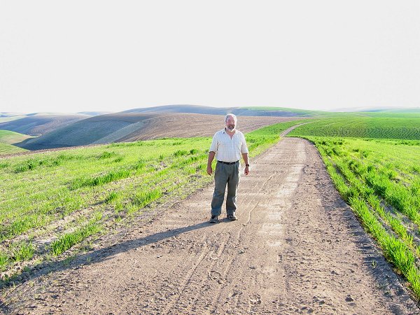
John on the road to Franklin County's Greatest Prominence Point (left center)
We drove out the soft dirt road to within a quarter mile of the summit, then got out and walked the last bit to the top in ankle-deep, wind-blown, loess soil as dust swirled at our feet. At the top, I thanked Aaron and Jeff for kicking steps for me. There was a crooked steel post in the ground with a bent, dirty survey sign lying at its base. This may have been a pretty silly goal, but it was somehow satisfying as well.
Summit push to 1584' Hunt witness post, Franklin County GPP
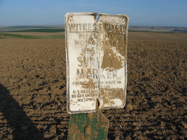
Hunt witness post
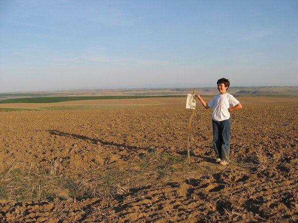
Aaron at the Hunt marker, GPP of Franklin County
After checking the National Geodetic Survey website when we got home, I see why we could not find the familiar brass benchmark that the map suggests is here. It's a 1933 disk in a chunk of concrete that was buried a foot under ground. The Hunt designation here is for Freeman Hunt, the owner of the farm in 1933.
The NGS 1933 report (as written, all in caps): To reach from Kahlotus, go S on the Pasco Highway 4.5 miles, turn left on road and go 1.8 miles to Mr. Hunts gate, go into Mr. Hunts yard, through a gate into the barnyard, then around a water tank and through another gate, then follow farm road 0.8 mile across wheatfield to the N end of a ridge, then though fence and go 0.4 mile to highest part of ridge and station Surface and underground marks are bronze station disks set in concrete. Surface monument is 1-1/2 feet square and is 1 foot underground as the station is in a ploughed field."
The Geodetic Survey went back in 1946 and made this report: All marks were found to be in good condition Station mark is stamped Hunt 1933 and is 16 inches below the surface of the ground. In 1968, when they checked again, they mention that the land was farmed by Mr. Ray Hunt.
Weekend stats: 19 summits (or close enough). 10.7 miles total hiking, 2400' vertical. We made it home at 11 PM, 830 miles RT.