1983 First Ascents
* 24Jul Surveyors Knoll' (6243) USGS Damnation Peak
* 24Jul Le Grand Boob'/Mamook Mtn' (6456) USGS Mount Triumph
* 7Aug Adolescent'/Black Beard Peak"(7241) USGS Mount Arriva
* 13Aug The One-Eyed Bull' (8120+) USGS Dome Peak
*?14Aug The Cheshire Cat' (8120+) USGS Dome Peak
* 25Aug Ozymandias Peak' (7647) USGS Skagit Peak
* 26Sep Pato Peak' (6800) USGS Damnation Peak
* 26Sep Alrac Peak' (6720+) USGS Damnation Peak
* 29Sep Whale Peak' (6559) USGS Snowking Mountain
* 29Sep The Razors Edge' (6000+) USGS Snowking Mountain
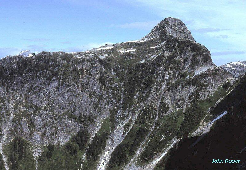
Surveyors Knoll'
I'm still looking for a good shot of my own, but here's one by rpc at summitpost (the flat form below Shuksan). It's hard to make this thing look like much, even though it does have 413 feet of prominence. It acquired this name from evidence of a visit by USGS surveyors (wood and wire debris landed and left here by helicopter on a field check, presumably in 1953). It's assumed that ours was the first party to walk over here on purpose from Despair.
July 24, 1983
Party: JR and Silas Wild
Mamook Mountain' now 6474' P674
Just NW of Triumph Pass which is on right, and Mount Triumph. Silas called this "Le Grande Boob," but the name has subsequently been politically corrected to Mamook, an active word in Chinook, meaning "to do, to work, to put into action," which one needs to undertake to get here. Perhaps the Mam and the ook will evoke thoughts of Silas' original concept to young minds.
July 24, 1983
Party: JR and Silas Wild
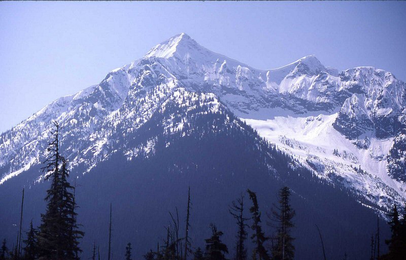
Black Beard Peak"
Ron originally felt this was an "Adolescent Peak," not a kid, but definitely not an adult in the neighborhood of Black Peak, Fisher Peak, and Repulse, so that's what we called it, but I like Dallas Kloke's term on this landform which combines the Black and Graybeard concepts.
August 7,1983
Party: JR and Ron Aronoff
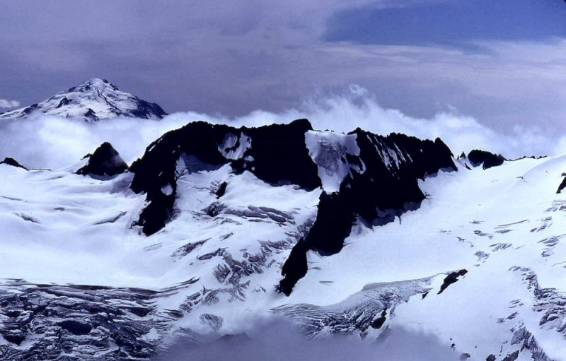
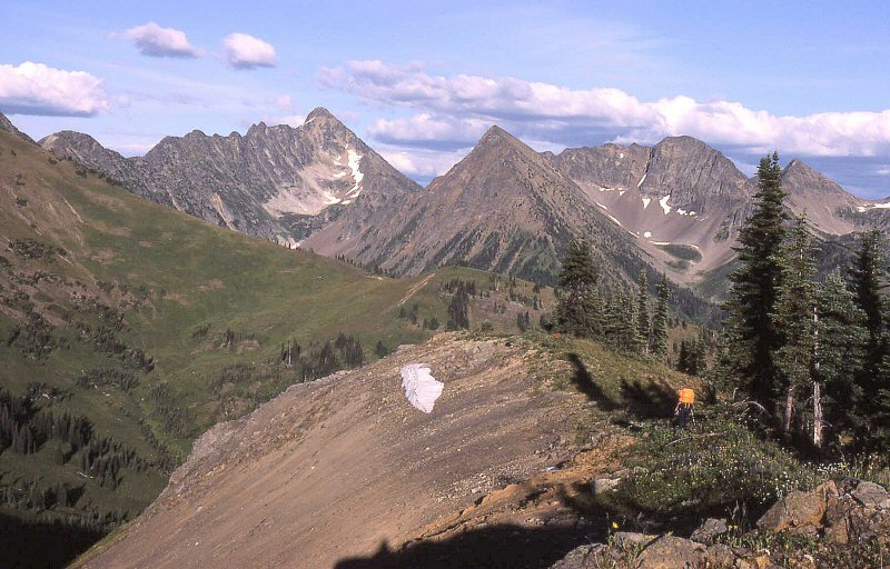
The One-Eyed Bull'
This unusual landform lies between Dome Peak and Spire Point. Named for its white snow face and missing eye. The map makes the right "horn" the high point. I'll have to go back and look. Our route was up the snow face here.
August 13, 1984
Party: JR, Russ Kroeker, and Dick Kegel
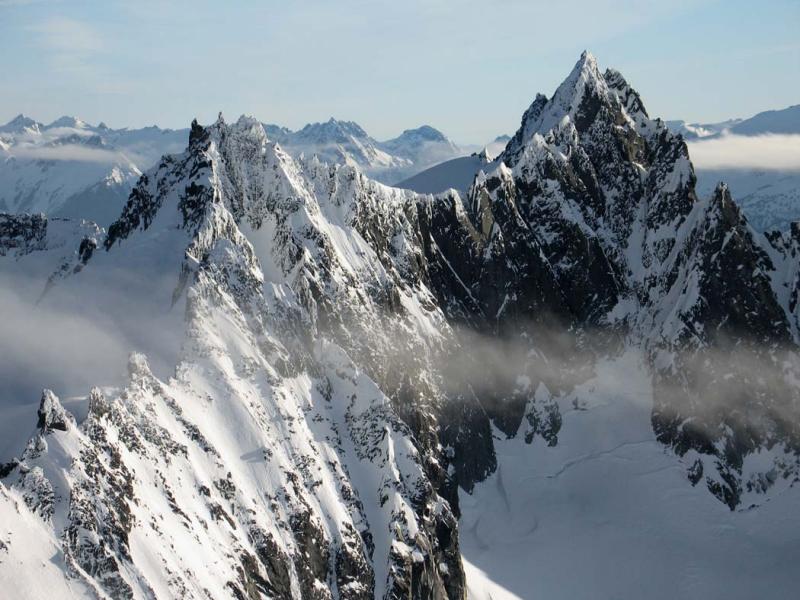
The Cheshire Cat' John Scurlock aerial photo
Just NE of Spire Point. The rounded cat's back and two sharp ears (on the left) are distinctive in this John Scurlock winter aerial.
Spire Point on right. Tom Miller has a great full-page shot of this in Cascade Alpine Guide, as well.
Party: JR, Dick Kegel, and Russ Kroeker
Ozymandias Peak'
is center sharp peak. Left center is Castle Peak, right is Freezeout Mountain, and Three Aunts. From the west.
August 25, 1983
Party: JR, Mary Quinn, Steve Allaback, and Joe (Alex) Medlicott
Alrac Peak'
Party: JR and Carla Patopea
Whale Peak'
Solo
Razor's Edge
Solo